Наши особенности
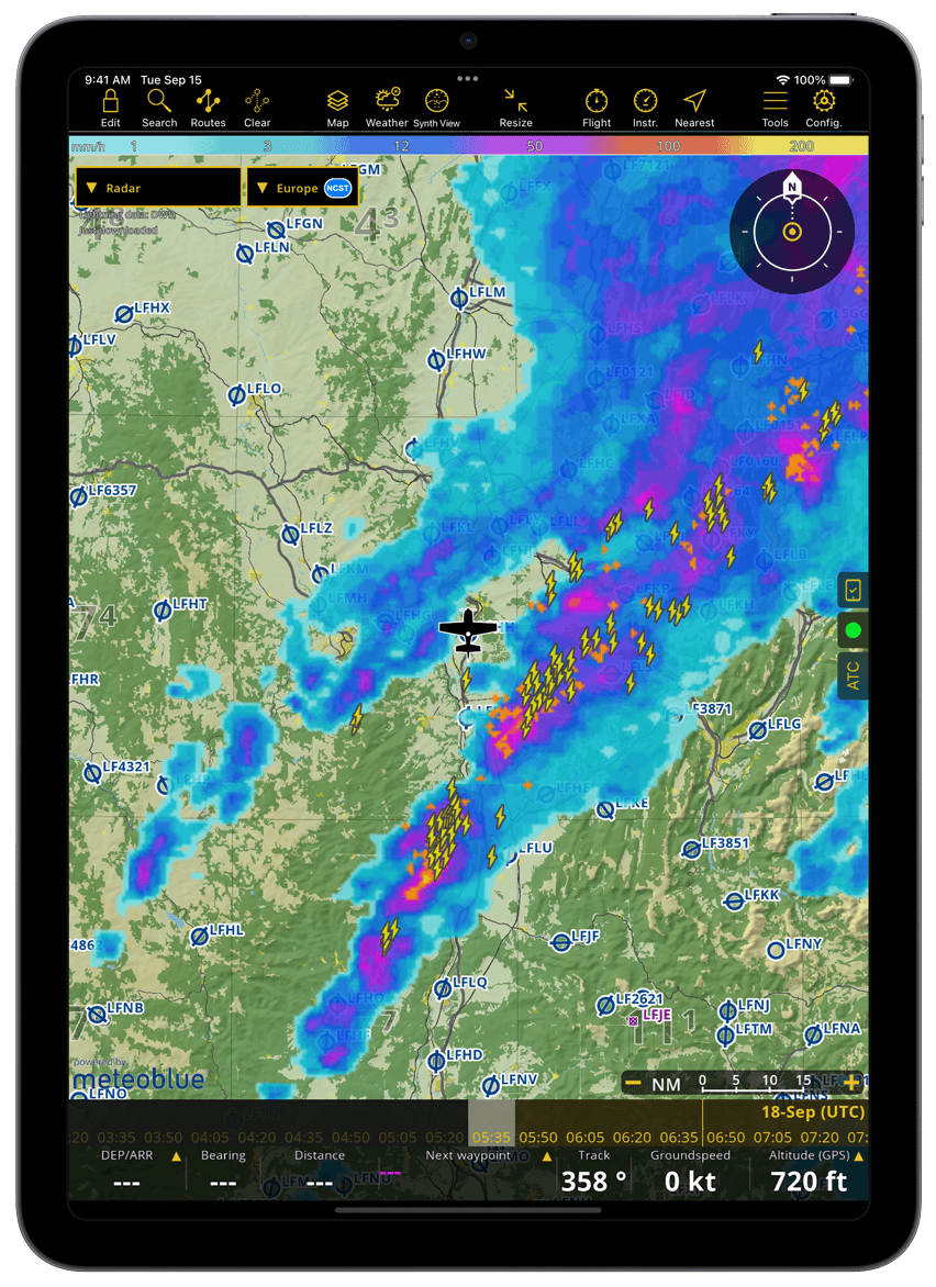
Расширенные погодные слои
- Отображается непосредственно на движущейся карте с прогнозными данными на срок до 3 дней вперед
- Включено во все планы: веб-камеры и прогнозы GAFOR для Швейцарии, Германии, Австрии, Балкан и Болгарии.
- Только Smart Advanced: радар дождя, ветер, облака и дождь, нижняя граница облаков, порывы ветра, видимость на земле и давление
- Постоянно обновляется через Интернет; прогнозы остаются доступными в автономном режиме
Планирование полета
- Создайте маршрут за несколько секунд прямо на интерактивной карте или введя один или несколько идентификаторов ИКАО на боковой панели.
- Ознакомьтесь с важной аэронавигационной и метеорологической информацией, связанной с вашим полетом (NOTAM, METAR, TAF, ветер)
- Создавайте, распечатывайте или делитесь полетными документами (навигационный план, вес и балансировка, инструктаж NOTAM)
- Представить план полета УВД
Интерактивная векторная карта
- Smartchart: рельеф местности по всему миру, путевые точки, воздушные пространства, NOTAM, топонимы, дороги, города, достопримечательности
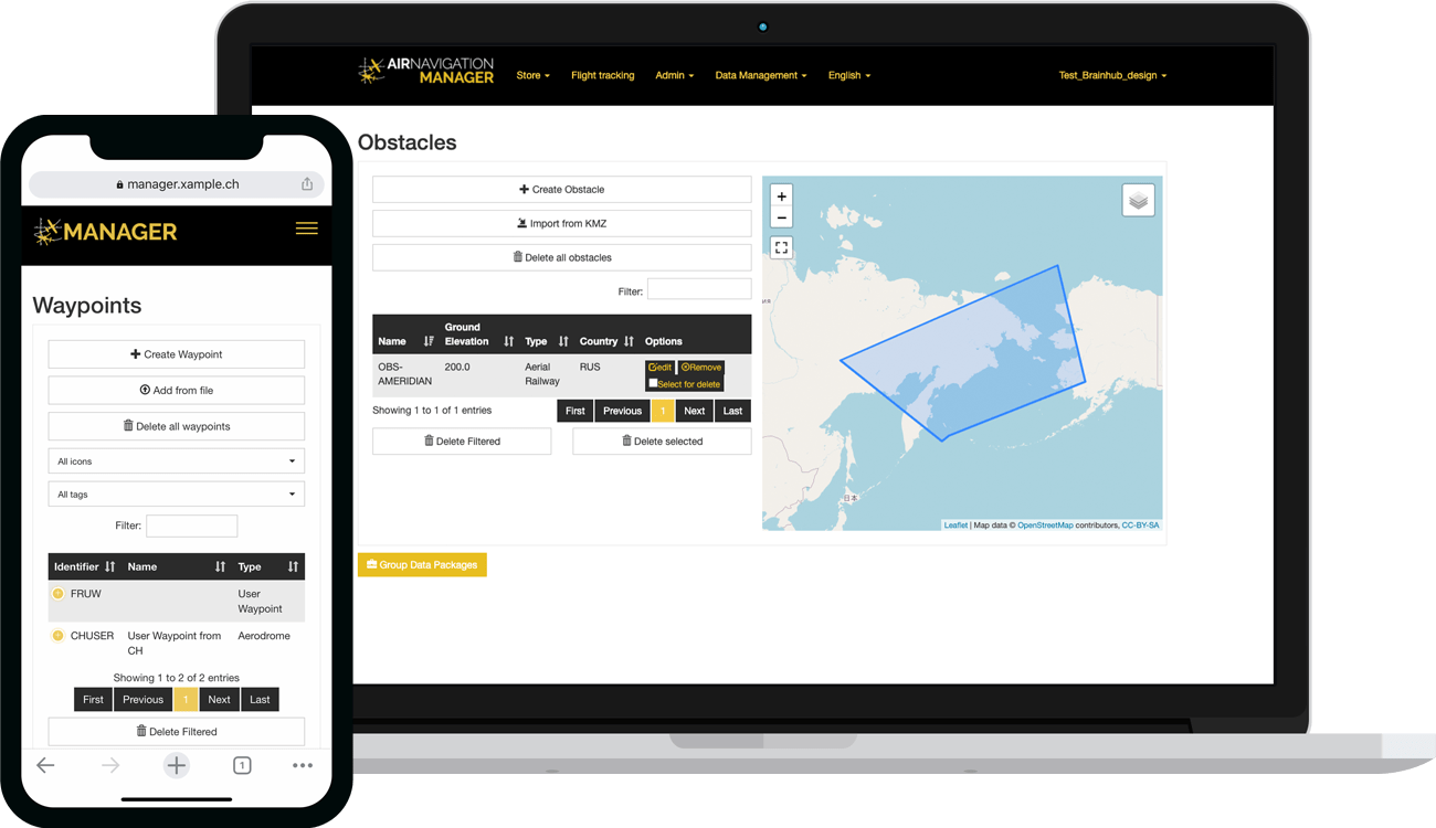
- Раскройте подробную информацию о точках маршрута, воздушном пространстве или NOTAM простым нажатием
- Препятствия для отдельных стран
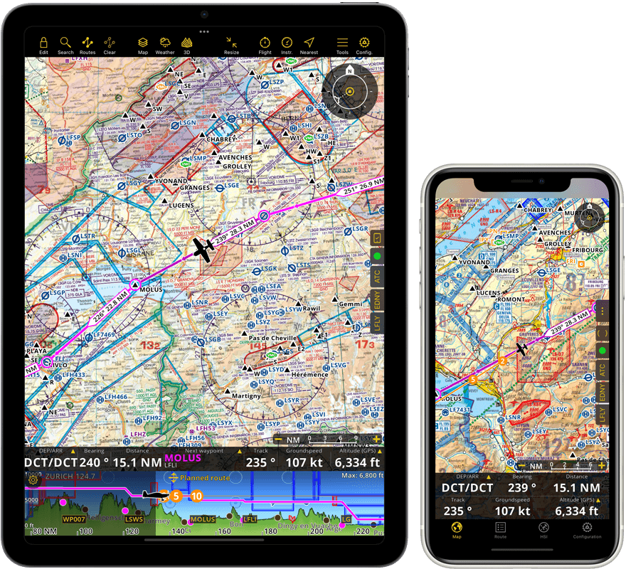
Аэронавигационные карты
- Официальная растровая карта ИКАО для большинства европейских стран
- Секционные и мировые растровые карты для США
- Аэронавигационные карты третьих лиц для Канады, Южной Америки, России, Австралии и других стран
- Топографические карты различных европейских стран
- Бесплатные карты ONC или OSM для стран, не имеющих других карт
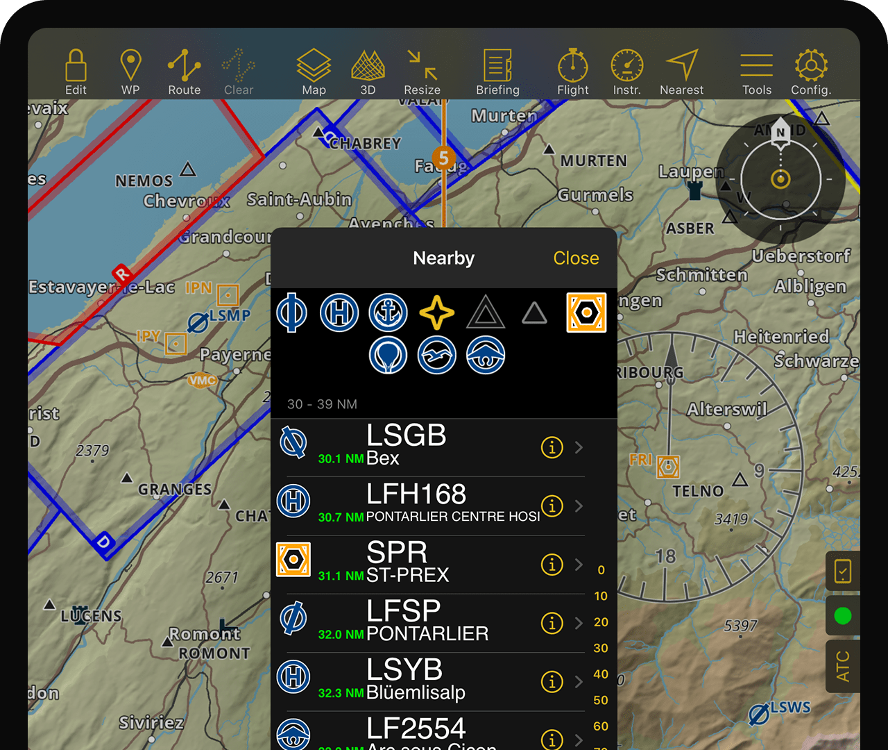
Базы данных
- Полная всемирная база данных точек маршрута и воздушных пространств
- База данных обновляется каждые 28 дней после цикла AIRAC.
- База данных препятствий обновляется еженедельно.
- Всемирная база данных улиц и адресов
Интерактивные NOTAM
- НОТАМ обновляются каждые 5 минут.
- Подробную информацию NOTAM можно раскрыть простым нажатием на карту или путем создания маршрутного брифинга.
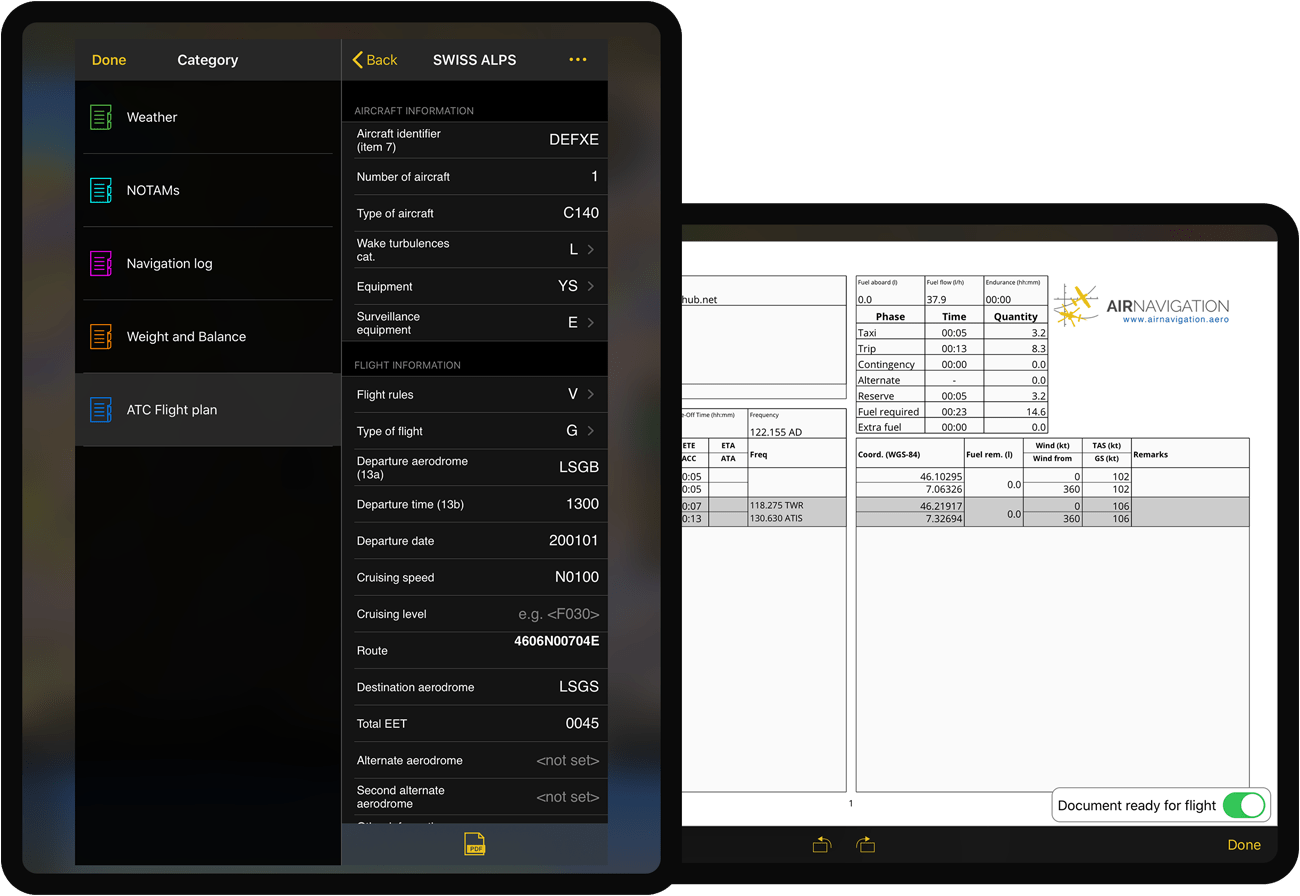
Планы ФПЛ
- Предварительно заполнено выбранной вами информацией о самолете
- Может быть легко подано в приложении
Облачные возможности
- Для операторов: управляйте парком планшетов, обмениваясь данными компании и синхронизируя их с вашими пилотами (необходима специальная бизнес-подписка)
Брифинг
Air Navigation Pro объединяет функции подачи ФПЛ, метеорологическую информацию и информацию NOTAM в одном документе, что позволяет более эффективно взаимодействовать с органами ОрВД.
Эта важная для вашей подготовки информация доступна в любой из наших подписок (Стандартной или Премиальной).
Движущаяся карта
- Ориентирован на север или курс, следует текущему положению GPS
- Следуйте запланированному маршруту на движущейся карте или с помощью значений отрезков пути
- Избегайте опасностей на местности с помощью встроенной системы TAWS и текущей высоты, определяемой GPS или барометром
- Значения навигации в реальном времени (скорость, курс, пеленг и расчетное время прибытия до следующей точки маршрута и многое другое)
- NOTAM и консультативные сообщения от других пилотов
- Другой трафик
Карты захода
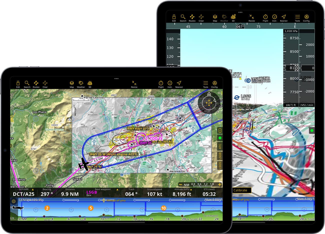
- Схемы подхода к аэропорту с географической привязкой автоматически появляются на аэродроме вылета и прибытия вашего запланированного маршрута.
- Документы AIP можно просматривать для аэродрома по вашему выбору.
- Распечатать документы AIP
Расширенные погодные слои
- Отображается непосредственно на движущейся карте с прогнозными данными на срок до 3 дней вперед
- Включено во все планы: веб-камеры и прогнозы GAFOR для Швейцарии, Германии, Австрии, Балкан и Болгарии.
- Только Smart Advanced: радар дождя, ветер, облака и дождь, нижняя граница облаков, порывы ветра, видимость на земле и давление
- Постоянно обновляется через Интернет; прогнозы остаются доступными в автономном режиме
Профиль полета
- Следуйте вертикальной навигации на виде профиля местности
- Избегайте ограниченных воздушных пространств или территорий
- Режимы просмотра вперед или запланированного маршрута
Ночной режим
- Пользовательский интерфейс приложения выполнен в темных тонах.
- Движущаяся карта и профиль высоты могут отображаться с цветами, настроенными для ночного полета.
Воздушная обстановка
- Интегрированный интернет-трафик благодаря нашему партнерству с SafeSky *
- Поддержка FLARM и ADS-B *
- Визуальные и звуковые предупреждения
- ADS-L4Мобильная поддержка ***
* Включено во все новые смарт-подписки
Служба слежения позволяет вам сохранять каждую секунду ваших полетов, записывая GPS-координаты и данные о высоте и скорости. Вернувшись домой, вы можете воспроизвести и проанализировать свой полет на движущейся карте или экспортировать его в виде файла KML, который можно просмотреть в Google Планета Земля. Вы также можете поделиться своим полетом с друзьями и коллегами.
*** При использовании интегрированной службы трафика SafeSky Air Navigation Pro использует экспериментальную версию ADS-L4Mobile для интерфейса для двунаправленного обмена трафиком. Ваше местоположение будет транслироваться более чем в 15 систем для максимальной видимости.
Блокнот
- Удобно откройте блокнот, проведя тремя пальцами справа налево
- Пишите брифинги, частоты и инструкции УВД пальцем
- Записи от руки прилагаются к бортовому журналу для дальнейшего изучения.
Инструменты
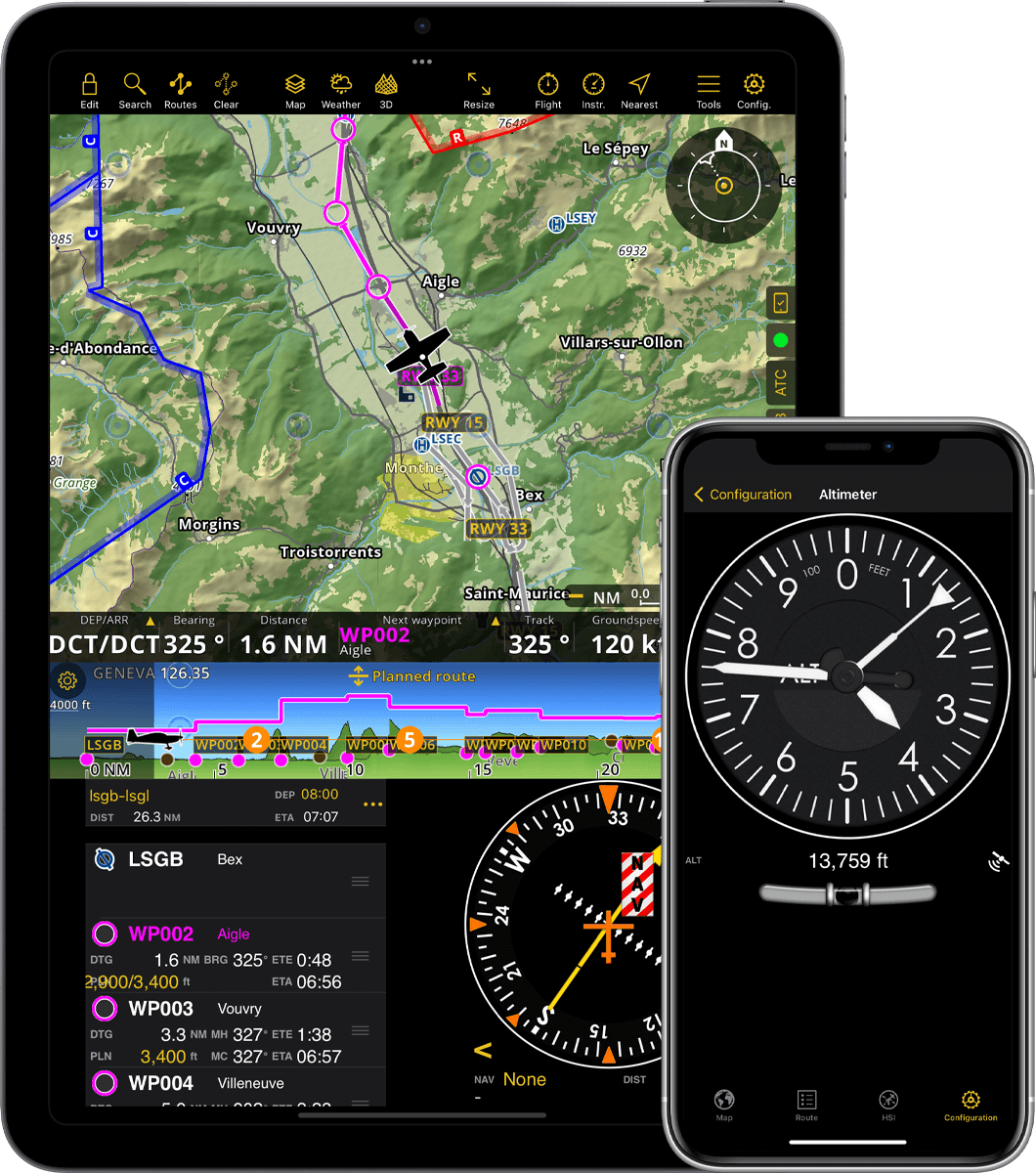
- Осуществляйте навигацию или обучение с использованием различных приборов, похожих на приборы для самолетов
- Выведите HSI, RMI, высотомер или любой другой прибор на главный экран
- Доступ к любому инструменту в любое время из меню
Уведомления
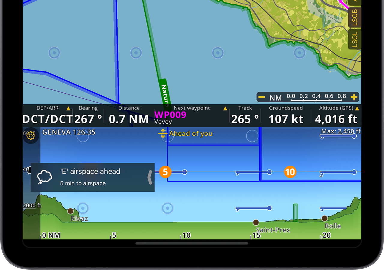
- Air Navigation Pro может информировать вас о достижении воздушного пространства
- Настраиваемые пользователем оповещения при отклонении от запланированного маршрута или выходе из эшелона полета или достижении его
- Когда обновление базы данных будет доступно, вы получите уведомление.
Вкладки
- Прямой доступ к информации об аэропорте и документам, связанным с вашим вылетом и прибытием
- Модуль УВД вычисляет сообщение с отчетом о местоположении на основе вашего текущего местоположения по GPS и других параметров полета.
- Панель состояния сообщит вам о проблемах с датчиками оборудования или конфигурацией.
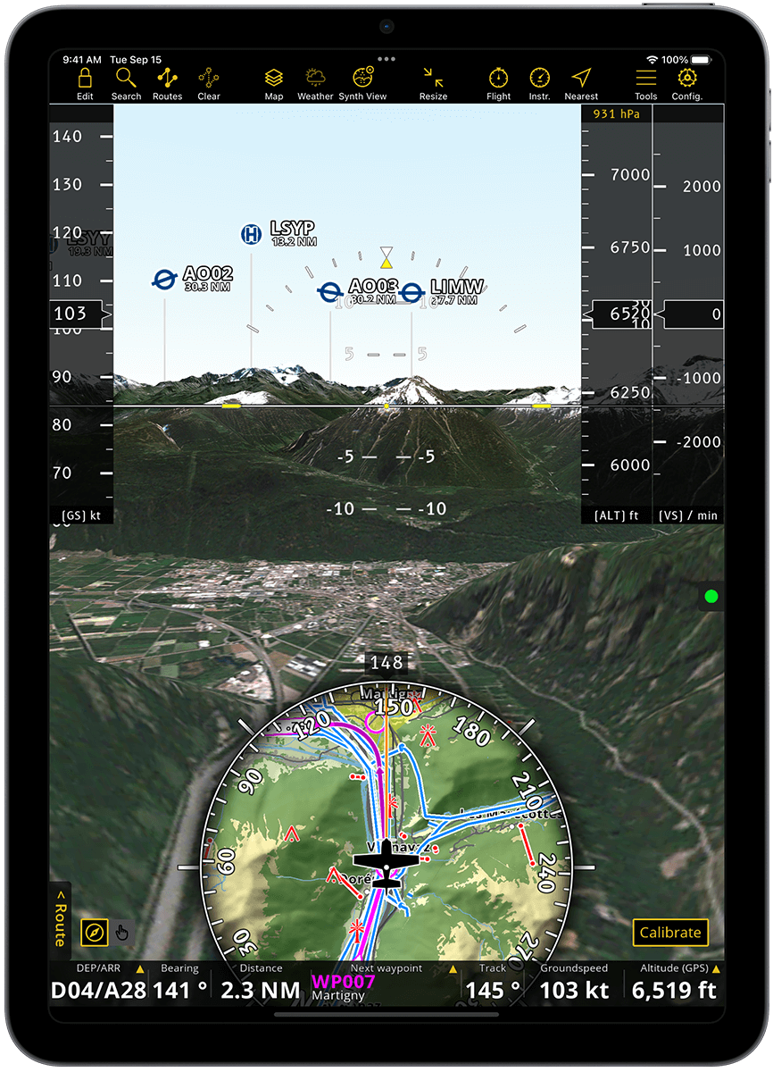
Синтетический взгляд
- Синтетическое зрение с учетом ориентации от внутренних гироскопов и акселерометров устройства
- Компьютерная 3D-модель рельефа на основе спутниковых фотографий
- Перемещайтесь по экрану, чтобы визуализировать места перед полетом к ним
- Оснащен искусственным горизонтом и предварительным просмотром движущейся карты, а также индикаторами высоты, путевой скорости и вертикальной скорости.
- TAWS и карты захода на посадку накладываются поверх синтетического вида
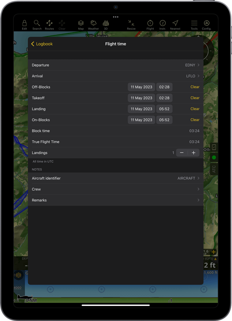
Автоматический журнал
- Время полета и блокировка, а также аэропорты вылета и прилета автоматически регистрируются и сохраняются в бортовом журнале.
- Бортовой журнал можно редактировать, добавляя пропущенные рейсы или комментарии.
- Отправьте бортовой журнал на свою электронную почту или компьютер
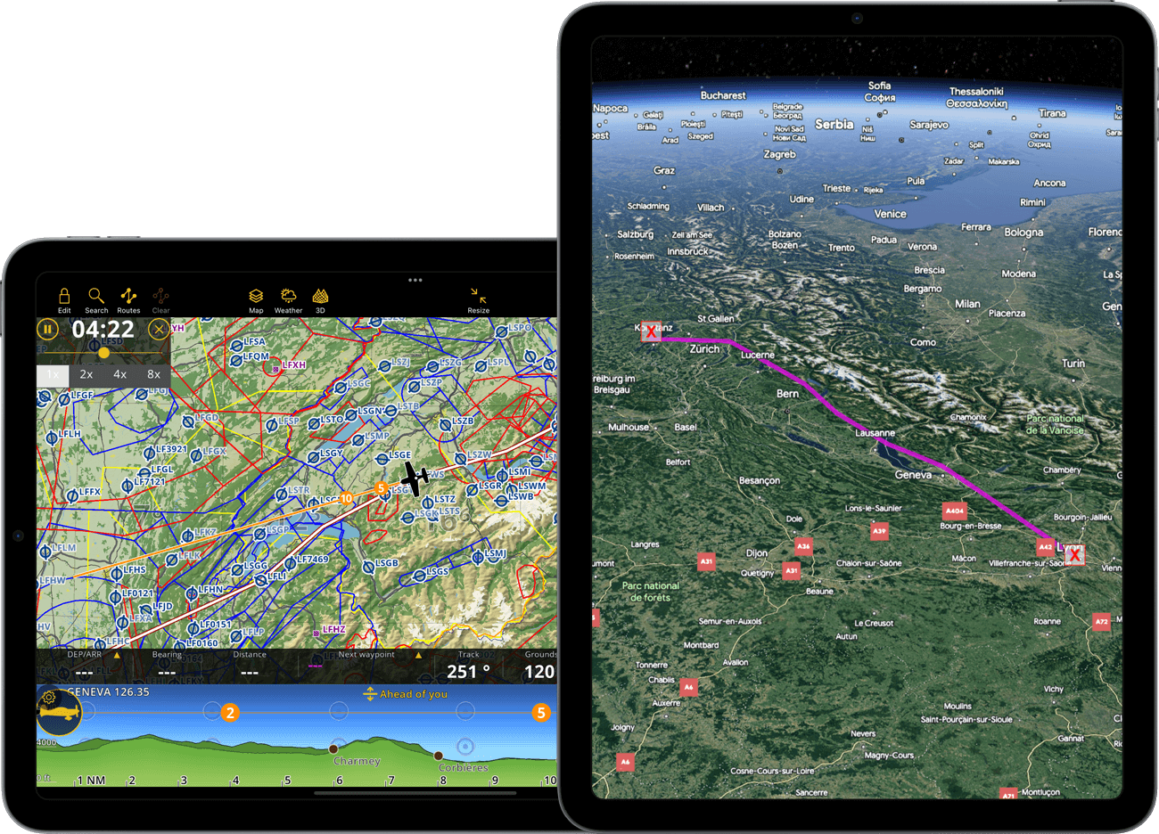
Запись полета
- Полеты регистрируются в базе данных
- Отображение траектории полета в реальном времени с цветовой кодировкой изменений скорости и высоты.
- Визуализируйте предыдущий маршрут полета на движущейся карте
-
Поделитесь полетом в режиме реального времени с друзьями или семьей через сеть GSM*
Используйте запись полета также для тренировки или для публикации в социальных сетях.
Воспроизвести полет
- Просмотреть трассировку предыдущего записанного полета
- Повторить полет
Служба слежения
- Поделитесь своими записанными полетами в своем аккаунте или по электронной почте
- Экспортировать трассировку в виде файлов KML или GPX

