Weather#
Thanks to our collaboration with MeteoBlue and Deutscher Wetterdienst, Air Navigation Pro offers advanced weather layers.
Note
Except for GAFOR and Webcams, this feature is only available for Smart Advanced subscribers.
Access#
On the tablet version, you’ll find the Weather feature on the Tablet Menu Bar. On the mobile version, it’s located inside the Map menu.
Tap on the Weather icon ![]() to activate/deactivate the weather layers.
to activate/deactivate the weather layers.
Once the weather layer is activated, an additional drop-down menu will appear in the left corner of the screen, allowing you to switch between the different layers. Forecast information is available for up to 3 days ahead, depending on the layer. A time slider will appear on top of the Navigation Bar. You may change the time of the displayed information by tapping on the desired time or by long-pressing on the time slider and sliding your finger left or right.
Available layers#
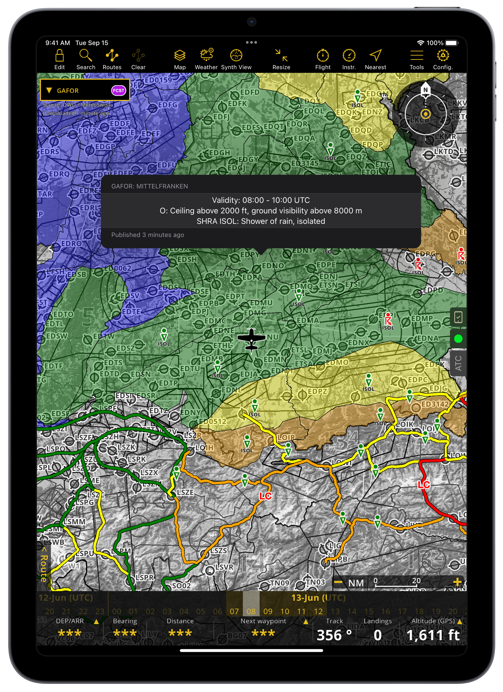
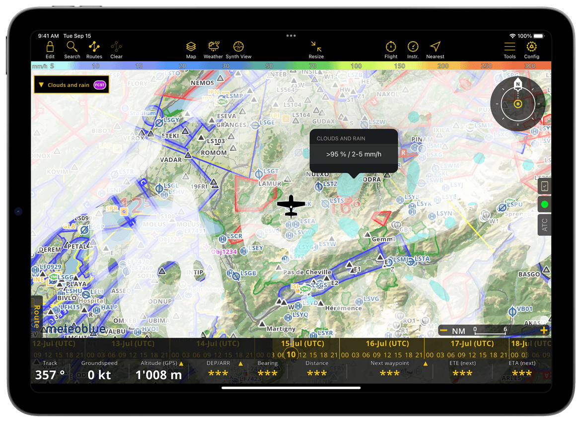
Find below the list of all layers we offer. Tap on any point of the map to see the exact weather values for that area.
Clouds and rain#
This layer displays the clouds in shades of gray and precipitation in shades of blue. The darker the gray, the thicker the clouds. The darker the blue, the more rain there is.
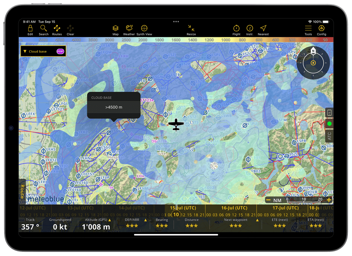
Cloud base#
This layer displays the altitude of the cloud base above sea level (MSL). The bluer the color, the higher the cloud base; the yellower the color, the lower the cloud base. The color legend for cloud base height at the top of the screen ranges from 5000 m to 0 m.
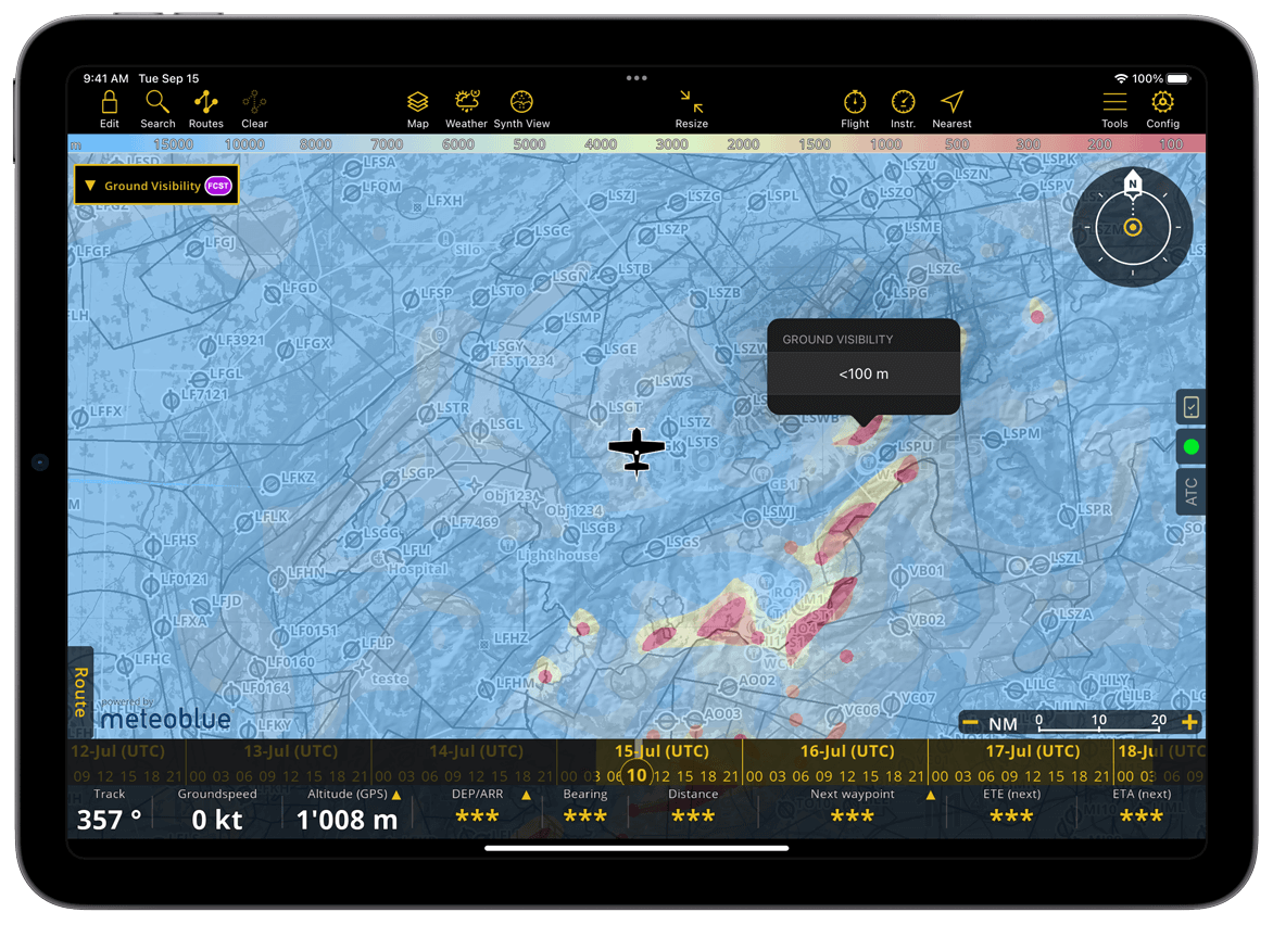
Ground Visibility#
This layer indicates the line-of-sight distance from the ground, which may be affected by cloud cover and terrain. For instance, visibility decreases in foggy conditions or when ground elevation reaches the cloud level, such as in mountainous regions. The color legend for visibility displayed on the top of the screen ranges from 15,000 m to 0 m.
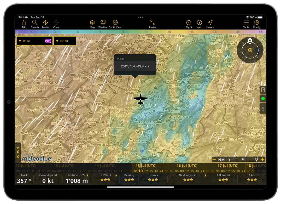
Wind#
The wind information is given through animation and color variation. The wind particles’ animation indicates both their direction and strength, visible through the movement speed. The color also shows the strength of the wind. The color legend for the wind speed is displayed on the top of the screen, ranging from 0 kt to 70 kt.
The wind layer is available for several altitudes, from 30 ft AGL to FL100.
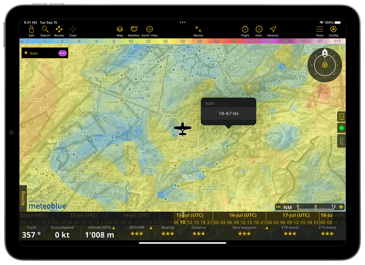
Gust#
This layer indicates the maximum strength of gusts. The color legend for gust speed ranges up to 120 kt. The animated direction of the gust is the same as of the Wind layer.
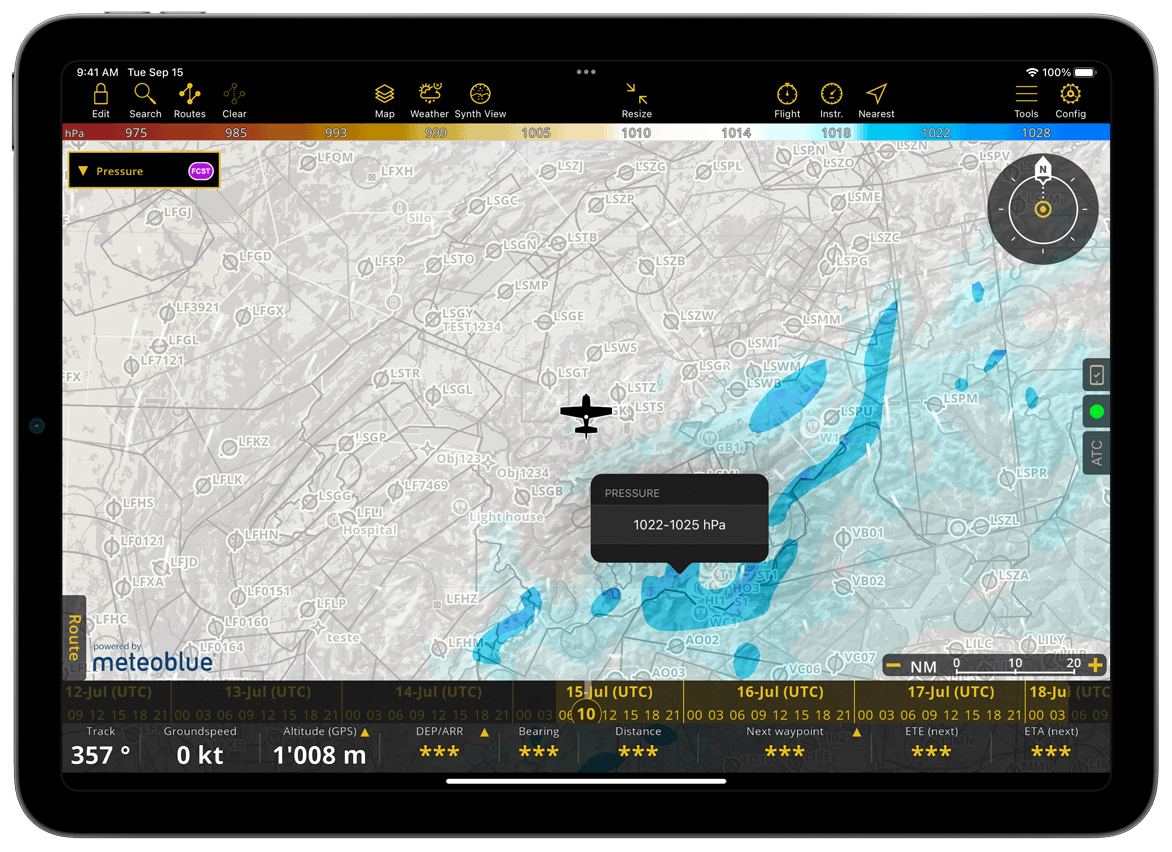
Pressure#
This layer gives the relative pressure in hPa. The color legend is displayed on the top of the screen.
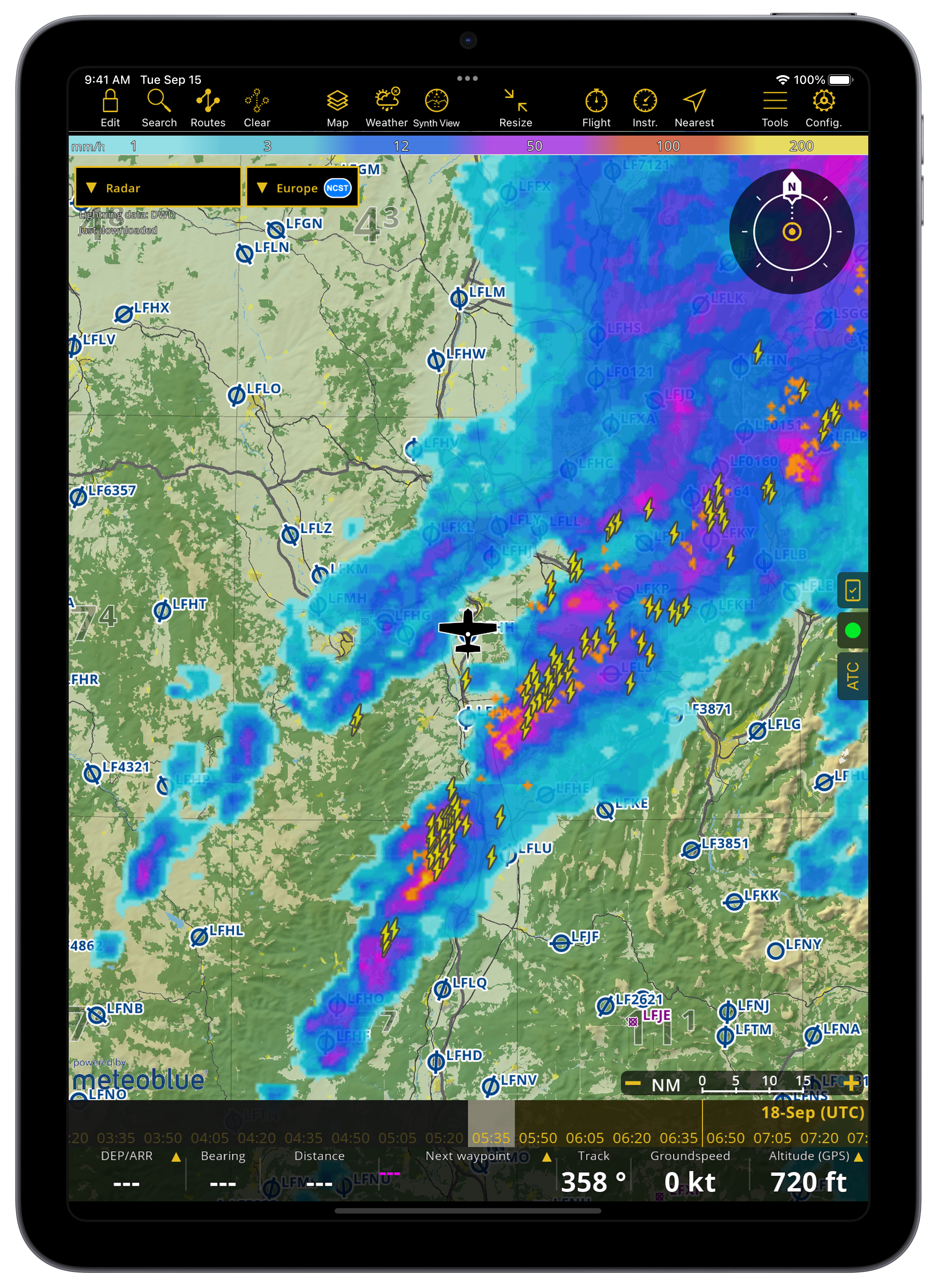
Radar#
This layer does not offer forecasts; it is based on measurements provided by the Deutscher Wetterdienst. It indicates the presence of rain as detected by ground stations, complementing the information provided by the Clouds and rain layer.
The radar is available for three regions: Europe, the US and Global.
Note
While Europe and the US radar layer provide historical data ranging up to three hours, the worldwide layer only covers a one-hour range.
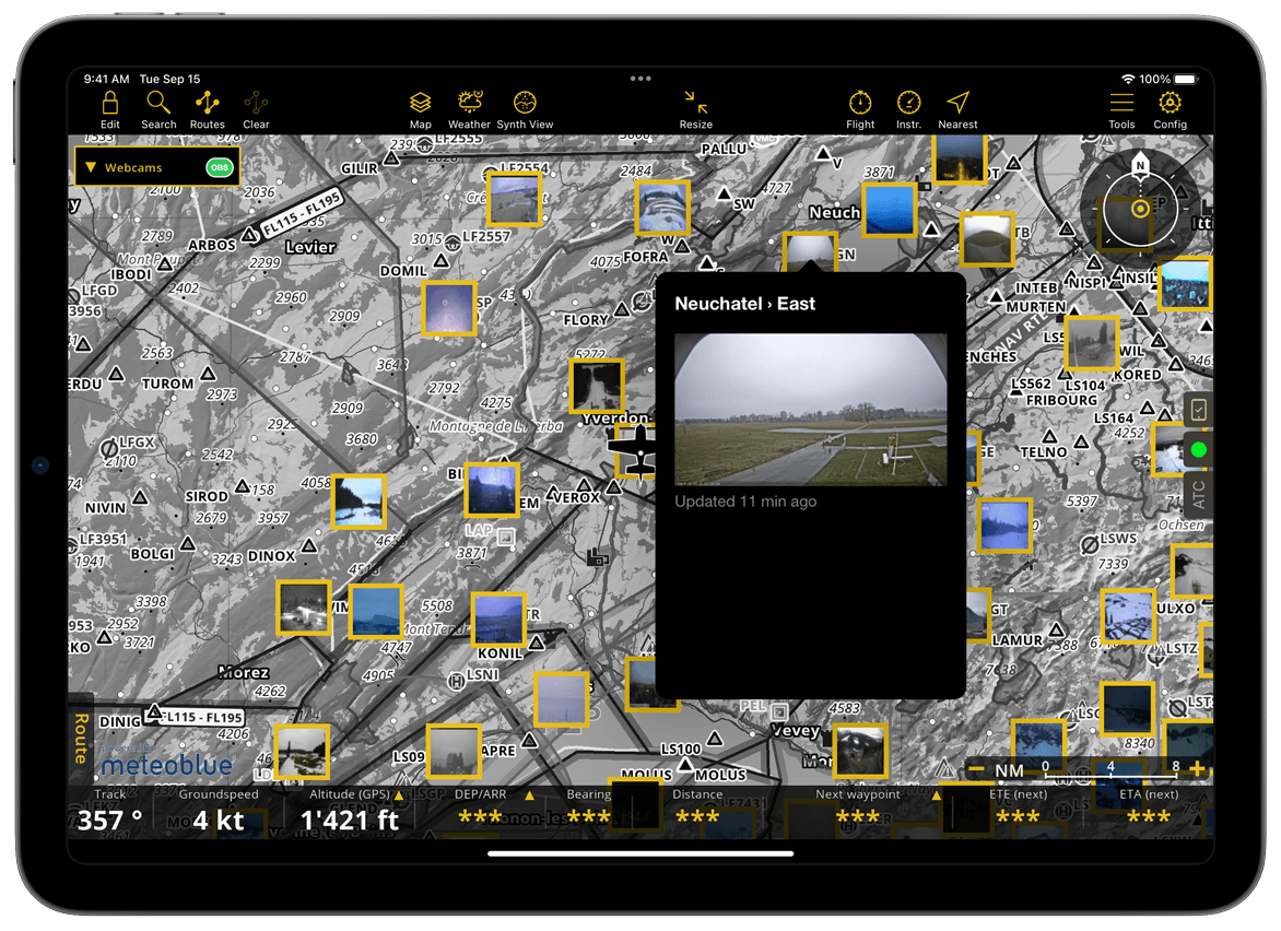
Webcams#
This layer provides real-time weather updates through webcams. The map will turn gray and webcams updated within the last hour will be displayed. Tap inside the yellow frames to open the webcam preview; tap anywhere outside the popover to return to the map view. To reduce clutter at lower zoom levels, fewer webcams are shown. Zooming in may reveal more available webcams.
Note
Unlike other layers, webcams are available with all subscriptions plans.
GAFOR#
This layer is only available for Germany, Switzerland, Austria and the Balkans. The information is refreshed every four minutes.
Important
In some countries, GAFOR is not updated during the night by the local authorities, resulting in a grayed-out display.
Note
Unlike other layers, GAFOR reports are also available to Smart Lite and Smart Classic subscribers.